More than usual in number and power! More “killer mega typhoons” will hit Japan one after another from now on!

Typhoons are becoming “more ferocious.
This year, another “killer mega typhoon” is set to wreak havoc on the Japanese archipelago.
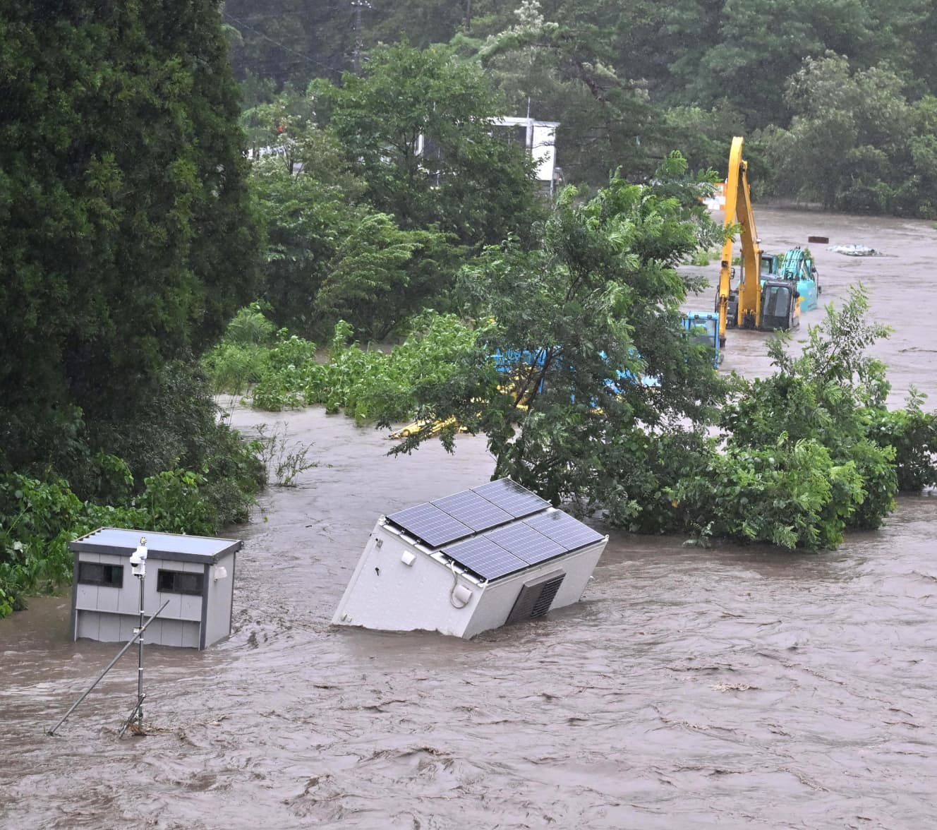
On July 30, Typhoon No. 8, with a central pressure of 980 hectopascals and maximum wind speed of 30 m/s, passed over Okinawa Island and made landfall in China. Typhoon No. 8, which maintained its strong force, brought torrential rainfall exceeding 500 mm in 72 hours, causing floods and landslides in China, resulting in an unprecedented disaster that killed more than 40 people.
According to forecasts by the Japan Weather Association, there will be a maximum of nine typhoons approaching Japan between August and October. Considering that the normal year is about four typhoons, this means that up to twice as many typhoons will approach Japan. Why are these forecasts being made?
Weather forecaster Koshi Murayama explains.
This year, the Pacific High over the south sea of Japan is strongly extending out. This high pressure makes it difficult for typhoons to pass over the Sea of Japan after they form over the South Sea, creating a route that makes them more likely to approach Japan than in previous years.
Experts are concerned not only about the increase in the number of typhoons approaching Japan. It is believed that the typhoons will remain in Japan for a long period of time after making landfall. The main cause is the northward shift of westerly winds,” analyzes Yoshihiro Tachibana, a professor at the Faculty of Bioresources at Mie University and an expert on abnormal weather.
Normally, typhoons that originate in the southern ocean make landfall in Kyushu, pass over the Kinki region, and then move northeast. This year, however, the westerly winds have been moving northward more than usual due to the extreme heat since around June. The westerly winds moving northward means that typhoons that land in the Japanese archipelago will no longer have the wind to shift their course to the east.
As a result, the number of typhoons approaching Japan and remaining stagnant is increasing. A symbolic case in point is Typhoon No. 5, which made landfall in Hokkaido on July 15. It was the first typhoon to make landfall in Hokkaido in nine years, since Typhoon No. 11 in 2004. In recent years, even experts have had trouble predicting the path of typhoons. Even places normally unaffected by typhoons no longer feel safe.
Possibility of a direct hit by a fierce typhoon in August and September.
In addition, typhoons this year tend to occur closer to Japan than in previous years. Typhoons are generated when the monsoon winds blowing eastward from the Indian Ocean collide with the easterly winds blowing westward from the tropical seas, but global warming and other factors are shifting the location where these two winds collide to the north. The time until the typhoon approaches Japan is shorter than in the past, and it is feared that it will make landfall while maintaining its strong force.
Mr. Tachibana continues, “The force of typhoons this year will depend on the strength of the sea water.
The higher the sea temperature, the stronger the typhoon will be. The higher the sea water temperature, the more likely it is that large amounts of water vapor will evaporate, creating huge rain clouds. As the typhoon passes through while capturing such rain clouds, the rain and winds become more intense. When I recently went to Sanriku off the coast of the Tohoku region to conduct a survey, I found that the sea water temperature was 5 to 6°C higher than in a normal year.”
According to research by Fumiaki Fujibe, a specially-appointed professor at Tokyo Metropolitan University, for every 1°C rise in sea water temperature, the amount of precipitation per hour brought by rain clouds increases by 7 to 19%. Similarly, as sea water temperature rises in typhoons, precipitation increases, increasing the risk of flooding and landslides.
Mr. Murayama sounds the alarm, saying, “Sea water temperatures near Japan are expected to rise by 7 to 19%.
Sea water temperatures near Japan peak around September every year. Therefore, there is a high risk of a fierce typhoon hitting Japan from August to September. Specifically speaking, there is a possibility of several powerful typhoons making landfall, with a strength of around 970 to 950 hectopascals, which can cause house collapses and large-scale power outages.’ In 2004, 10 typhoons made landfall on the Japanese archipelago, causing extensive damage, and it was called the “year of disasters,” but we may see a similar situation.
The series of typhoons that continue to grow more ferocious and make landfall is just around the corner.
From the August 22/29, 2025 issue of “FRIDAY
PHOTO: AFRO Kyodo News