Noto Peninsula Earthquake Submerges Tokyo Dome Land
Was this really a port? - Local residents "can no longer go fishing
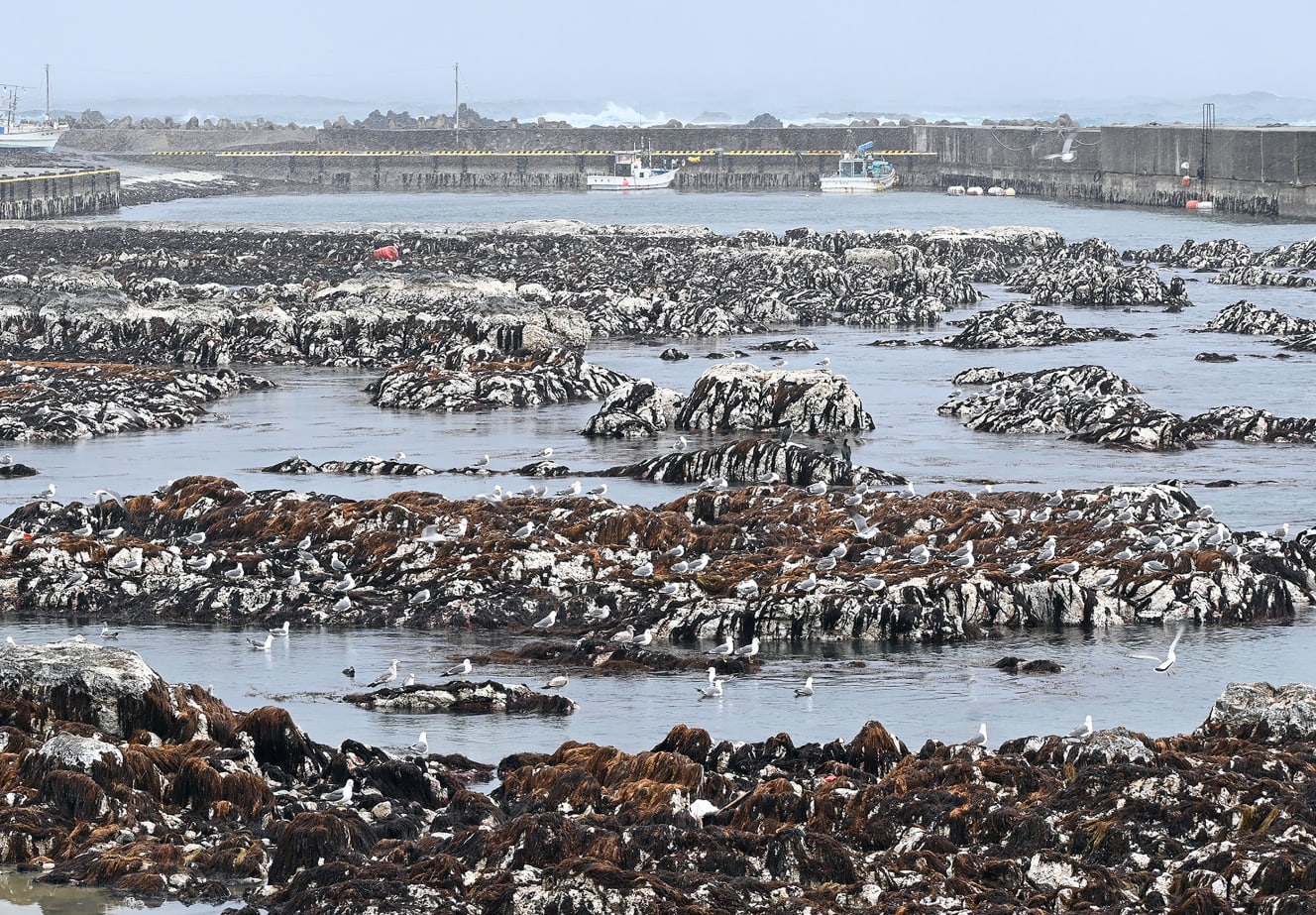
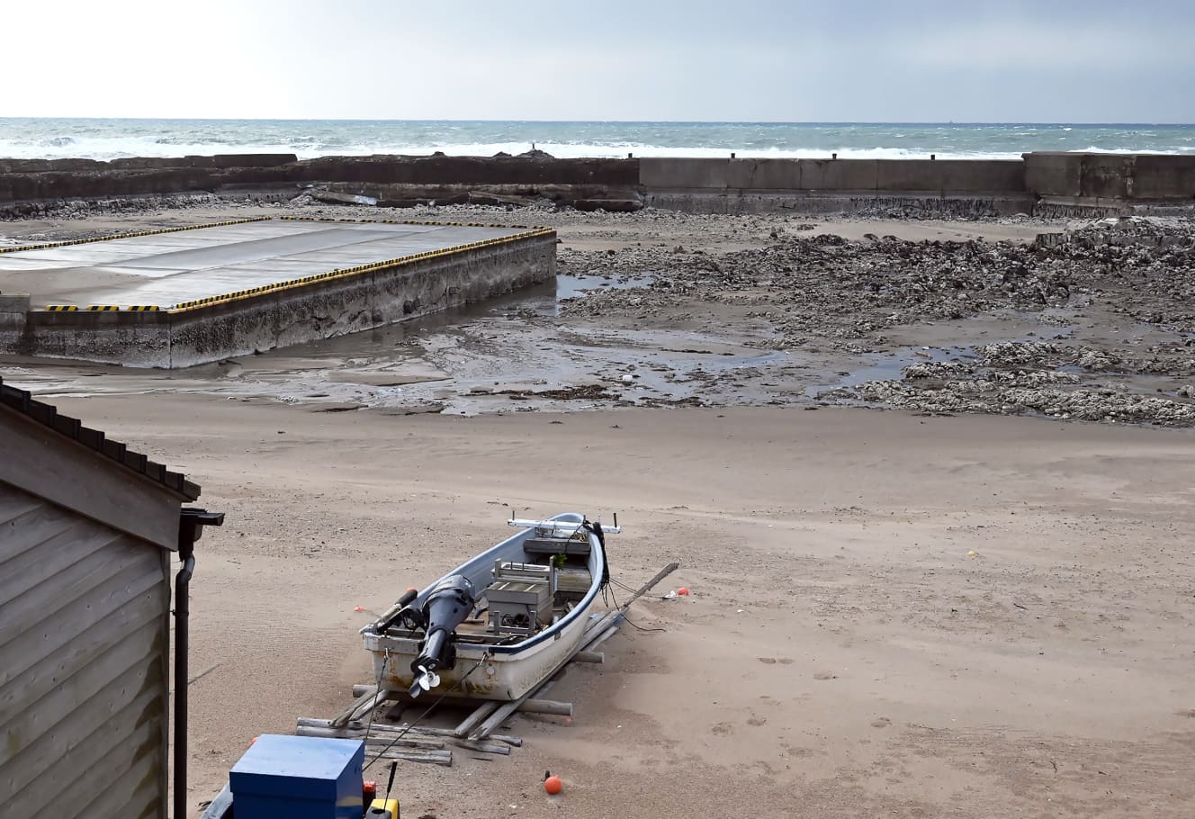
The water has receded from what was originally the sea, leaving the seafloor bare. The area was littered with dead crabs and starfish, and a foul odor lingered in the air.
This was the scene at a port in Monzen-cho, Wajima City, Ishikawa Prefecture, where the FRIDAY reporter visited. It has been more than two weeks since the Noto Peninsula earthquake, which had a maximum intensity of 7 on the Japanese seismic scale, hit the prefecture. The shocking sight of the coastline was enough to make one wonder, “Was this really a port?
I have been fishing for decades, but I have never seen anything like this. The sea water has receded from the harbor and the boats are not floating. …… I’m worried that we won’t be able to fish anymore.
What exactly happened to the sea in Ishikawa? According to the Geospatial Information Authority of Japan (GSI), the ground rose up to 4 meters due to this major earthquake. According to the Geospatial Information Authority of Japan (GSI), the earthquake caused the ground to rise by up to 4 meters, and a vast area of 4.4 km2, or about 94 times the size of Tokyo Dome, was transformed from sea to land over a distance of about 90 km.
The uplifted land has moved up to 200 meters away from the original coastline. The average rate of land uplift is about 1 mm per year. But in just four to five seconds immediately after the earthquake, uplift of up to four meters occurred. A simple calculation shows that 4,000 years’ worth of uplift occurred all at once,” said a reporter from a national newspaper who covered the event.
According to Ishikawa Prefecture, uplift was confirmed at 15 ports in the prefecture. Professor Shinji Toda of Tohoku University’s International Research Institute of Disaster Science explains the background behind the bizarre natural phenomenon.
In the Kumamoto earthquake in April 2004, the active fault moved horizontally. This time, the active fault moved vertically, causing the ground to uplift. Moreover, the western end of the fault, which is 120 km long, curved along the Noto Peninsula.
How will this affect the sea in Ishikawa? The fishermen’s worries are only deepening.


From the February 2 and 9, 2024 issues of FRIDAY
PHOTO: Masahiro Kawayanagi